ClimateLab provides research-based consultancy and conducts
analyses of marine and climate processes using numerical ocean
circulation models. High-resolution models are configured for the
marine region most relevant for your project. ClimateLab operates a
range of models covering areas of particular relevance to the North
Sea–Baltic Sea region, including the inner Danish waters, as well as
coastal areas and fjord systems around Greenland.
The models are based
on the physical processes governing ocean circulation and mixing, such
as tides and wind forcing. They are coupled with modules describing
the state variables of interest, for example dissolved oxygen
concentration or the abundance of plankton and fish larvae. These
variables are represented according to conservation principles,
including mass conservation, together with the physical, chemical, or
biological processes that characterize the selected variable.
The
circulation models compute current velocity and direction, as well as
the turbulence generated by wind forcing, surface heating and cooling,
and internal shear within the water column or interactions with the
seabed. Simultaneously, the models calculate water temperature,
salinity, and other variables of interest, such as phytoplankton
biomass or the dispersion of nutrients and other chemical substances
released from point sources.
The models are
executed on ClimateLab's in-house computing
infrastructure. Technically, they run on small Linux clusters using
OpenMPI for parallel computation.
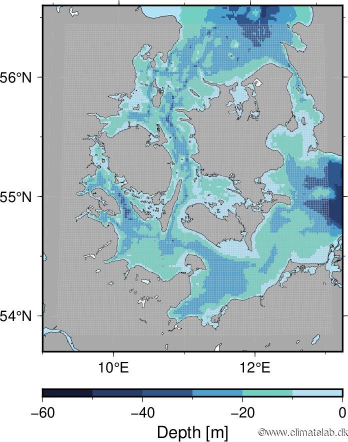
The inner Danish waters are a relatively shallow marine region connecting the Baltic Sea with the North Sea and the North Atlantic. The deeper parts of the Kattegat are characterized by high salinity due to inflows of dense bottom water from the Skagerrak, while the surface layer has relatively low salinity because of the outflow of brackish water from the Baltic Sea. This salinity gradient creates a persistent stratification that limits vertical mixing throughout much of the region. As a consequence, areas with high biological productivity are particularly vulnerable to hypoxia, since the stratification restricts the transport of oxygen to deeper waters. Water exchange between the coastal zone and the open sea is primarily driven by wind forcing. Periods of strong winds can induce wind setup and significantly enhance the exchange of water masses in both the surface and bottom layers. ClimateLab develops and applies high-resolution hydrodynamic circulation models of the Danish inland waters to simulate transport processes, sediment dynamics, biogeochemical processes, and the dispersion of chemical substances. The models are based on the governing geophysical fluid dynamics equations and resolve the complex interactions between physical, chemical, and biological processes. The model domain illustrated above shows the computational grid covering the central part of the study area. Each grid cell contains up to 16 computational points at which currents, temperature, salinity, and the transport and transformation of dissolved and particulate substances are calculated. Open-boundary conditions towards the Baltic Sea and the northern Kattegat are provided by a larger-scale model covering the combined North Sea–Baltic Sea region.

The North Sea connects the Baltic Sea region to the North Atlantic through the English Channel and the passage between the Shetland Islands and Norway. The North Sea is relatively shallow, except for the Norwegian Trench, which exceeds 700 m in depth and extends into the Skagerrak. The Kattegat and the Danish Straits form the transition zone between the saline waters of the North Sea and the brackish waters of the Baltic Sea. Consequently, the inner Danish waters constitute a major frontal zone separating these two water masses. The outflow of Baltic Sea water through the Danish inland waters is strongly influenced by mixing processes in the narrow straits, including the Great Belt, the The Sound, and the Little Belt. Tidal dynamics in the North Sea are complex because they are driven by tidal waves propagating from both the north and the south. In contrast, tides in the Baltic Sea are comparatively weak due to the hydraulic restriction and friction imposed by the Danish Straits. ClimateLab develops and applies hydrodynamic models covering the entire North Sea–Baltic Sea region. These models are driven by meteorological forcing, freshwater runoff from land, and open-boundary transports across the northern North Sea and the English Channel. In addition to providing regional simulations, the North Sea–Baltic Sea model supplies boundary conditions for higher-resolution models of the Danish inland waters.
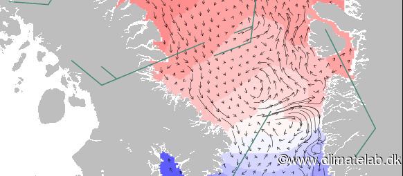
The fjords of Greenland were originally carved by glaciers that eroded the crystalline bedrock during successive ice ages. As glacier tongues advanced from the Greenland Ice Sheet towards the coast, they formed the deep, U-shaped fjords that were later inundated by seawater as the ice retreated. Stepwise glacier retreat driven by climatic variations created shallow sills that now restrict the exchange of deep water between the fjords and the adjacent ocean. Arctic fjords exhibit pronounced seasonal variability, with sea ice covering many fjords during winter and substantial freshwater input from glacier melt during summer. As a result, these fjord systems are characterized by complex circulation patterns controlled by both climate and the dynamics of the Greenland Ice Sheet. Marine-terminating glaciers can strongly influence the inner fjords by generating enhanced mixing and turbulence, as well as episodic, high-discharge meltwater plumes. ClimateLab develops and applies high-resolution 3D hydrodynamic models of Arctic fjords and coastal waters to simulate ocean circulation, mixing processes, and the transport and fate of dissolved substances.
ClimateLab
Symbion science park
Fruebjergvej 3
2100 Copenhagen O, Denmark


